I was scrolling through a social media feed the other day when I saw a map that blew me away.
I’m a bit of a map geek, so I clicked the graphic to give it a closer look. It was posted by The Nature Conservancy.

What it shows are the various regions that make up the Mississippi River watershed. We all know that the Mississippi is huge, one of the world’s great rivers. And yes, a lot of us know that there are a number of big rivers that feed into it. But seeing it on a map like this is a great visual that illustrates how much of our country is connected by this amazing river system. From New York to the east, Montana and Idaho to the west, Canada to the north and all the way to the Gulf of Mexico via Louisiana to the south. Thirty-one states in the U.S. and two Canadian provinces are part of this watershed.
Even at great distances, we are all connected.
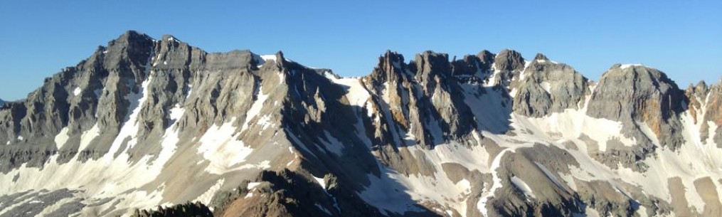
I live within a few hundred yards from the banks of the Arkansas River. The river begins in the heart of the Sawatch Range of the Colorado Rocky Mountains, getting its start atop mountains like this one, Mount Shavano, just outside of Poncha Springs (the actual headwaters are farther north, more toward Leadville, but I digress)

The summit of Mount Shavano, Colorado.
From snowmelt and rain runoff at these heights, the river cuts through valleys and gorges through Colorado before beginning its slower, wider meanderings through Kansas, Oklahoma and Arkansas before emptying its contents into the Mississippi River far to the east.
Here’s what the river looks like about five miles south of me right now.

The Arkansas River, as seen from its west bank in Tulsa.
Hard to imagine that the snows atop that 14,000-foot peak in the first photo will eventually roll on by in my hometown hundreds of miles away. But that’s exactly what happens, more or less.
This is a story told over a huge swath of the country. Along with the Arkansas, the Missouri, Red, Ohio and Tennessee rivers, fed from mountain streams in the Rockies and the Appalachians, make up this sizable network of waterways. Snowmelt from the north woods of Minnesota finds its way to the bayous outside New Orleans.
If there is a point to be made, it’s that the things we do locally don’t stop at our doorstep. Decisions made in Montana and Indiana can have consequences in Missouri and Louisiana. Aside from the impressive scale the watershed represents, there is the realization that what we do upstream affects a lot of people downstream.
Anyway, just some food for thought. If you want to learn more about the America’s Watershed Initiative, click this link.
Bob Doucette

You found a connectedness that is often overlooked. I’m just downstream on the map there, just to the right of your bend in the river (easy distances on maps).
Pretty interesting stuff. And I could look at maps of this kind of thing for hours.