Washington state hiking: A walk up Mica Peak

There are some states where if you don’t find a way to get outside and step on a trail, you’re doing yourself a disservice.

Washington is one of those states. Three mountain ranges cross the state from north to south: The Olympics, the Cascades, and to the east, the Selkirk Range.

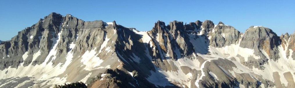
The Selkirks won’t garner the love that the Olympics or the Cascades get, but if you’re in Spokane or the Idaho towns to the east, there’s plenty to do and see.

One of the simple pleasures for the outdoorist is a long mountain hike. And just east of Spokane Valley, you have one in Mica Peak.

The mountain is easy to distinguish: There’s a white, globe-like structure perched at its summit, like some giant golf ball awaiting God’s tee time (in reality, it’s an FAA radar station).

My hiking buddy on this one, Doug, lives in Spokane Valley and he sees the mountain every time he walks out his front door. He’s been eyeballing this ever since moving here with his family about a year ago. I needed a good training hike, so up we went.

There are a lot of trails on this mountain, and the paths themselves are a mix of jeep roads, singletrack and, close to the top, a wide gravel road. There are a lot of side trails, too, so it’s a good idea to study a map before you go. Otherwise, it’s easy to get off course (we did that a few times and turned an 11-mile out-and-back summit hike into some just over 13 miles. Oops.).

The basic route we followed was looking for markers that pointed toward “Moonshine.”

That path has you choose between what look like a fork in the road (really, two jeep trails) early on. The more established one to the left is the way to go. The route will mostly stay on a path like this following the ridgeline for a few miles. Some might balk at the idea of hiking on a jeep trail, but the scenery is just as good from it as it would be any singletrack. Sweeping overlooks into the valley to the west as well as nearby wooded ridges abound as you ascend, though we had a hard time seeing many of them because of the weather: Clouds, light rain and even some fog obscured most of the views on the way up, though there is an appeal to the look of a misty forest, where stands of trees disappear into the gloom of the fog. A whole different feel for sure.

Not far from the top, the route changes its spots: Double-track jeep trails give way to an abrupt right turn up a steep singletrack path that ascends sharply for about a quarter mile. Most of the route to this point is a gentle but steady incline, but now at about 5,000 feet, you give your legs and lungs more of a test. Once we topped out there, we were greeted by two things: a sweeping view of the valley below, and that gravel road I mentioned that continued up. The slope eased some here, and before we knew it, the FAA’s giant golf ball appeared through the mists. We’d topped out.

As I said before, the weather gave us light rain and drizzle most of the day. But by the time we were at the summit (and lunch!) it was 38 degrees and snowing. Yup, late May in the mountains – even mountains that don’t quite reach a mile above sea level – can bring snow. It was a tasty but chilly lunch, and we didn’t waste too much time getting a move-on.

On the way down, the clouds lifted a little, and we were treated to better views. There was plenty of evidence of wildlife (Spokane County maintains much of the mountain for recreation and as a nature preserve), be it droppings from deer or, we suspected, large predators. One paw print looked like it very well could have been from a decent sized cat. Mountain lions, black bear, moose, elk, deer and more call these woods home.

In the middle of all this was conversation. You know you’ve found a good hiking buddy when you don’t run out of words (though I’ll admit to clamming up on higher altitude peaks). Discussions included cars, family, sports, jobs and more. It definitely makes those miles tick by faster.

By the time we got back to the trailhead, the sun was poking through the clouds, which were busy trying to clear out. Mica Peak’s summit was still hidden in clouds, but somewhere up there was that giant golf ball in the sky, something Doug will be able to show his kids and say, “I’ve been up there.”

About the route: If you do it right (and not get off track like we did), the round-trip hike is about 11 miles with somewhere near 2,500 feet of vertical gain. All Class 1 hiking, with a short stretch of steeper Class 2 close to the top just before you reach the gravel road. The true summit is a fenced-off FAA site that does not have public access.

Bob Doucette

Hiking Colorado’s Humboldt Peak

Humboldt Peak, as seen from Broken Hand Pass. (Mike Zee photo)

Note: This is the next in a series of trip reports focusing on route descriptions rather than storytelling. Photos and beta only!

Colorado’s Sangre de Cristo Mountains offer some of the finest alpine adventures you can find in the southern Rockies, with anything from beefy hikes to serious climbs. The peaks are more remote, being that they’re not that close to any larger cities, and some of them require a sturdier vehicle to reach trailheads.

One thing about the Colorado Sangres 14ers: There are not a lot of easy entry point peaks. All but a couple are Class 3 and 4, and some of them are among the toughest of the state’s 14,000-foot peaks.

But if you’re looking for a mountain that will give you those spectacular Sangres views without the commitment of a Class 3 or 4 climb, then Humboldt Peak might be your ticket.

Humboldt is one of three 14ers surrounding South Colony Lakes and is accessible via the same road and trailhead. It’s technically a walk-up, though I found a couple of more difficult scrambly sections higher on the mountain. The big reward for reaching Humboldt’s summit is the incredible platform to see Crestone Needle and Crestone Peak, just west of South Colony Lakes. That alone makes Humboldt’s summit a worthy prize.

There are two ways to get to the top: One is via the very long east ridge, the other a shorter route with less vertical gain via its west ridge. This will be about the latter.

You can drive on 120 Road near Westcliffe for a short distance to a two-wheel-drive trailhead or, if your vehicle is four-wheel-drive and capable, continue 2.7 miles to a gate that marks the end of the drivable portion of the road.

Easy hiking past the road and into the woods near South Colony Lakes.

From the four-wheel-drive trailhead, hike up the road past the gate and over a foot bridge until you reach a trail junction turnoff to your right. Follow easy trail hiking through the woods and past some campsites. (Many people hiking Humboldt or climbing the Crestones choose to backpack and camp here, then begin their ascents the next day. It’s a beautiful place to camp.)

Humboldt Peak, as seen from the south. (Mike Zee photo)

Gaining altitude, and seeing Crestone Needle along the way.

You’ll be hiking the trail east of and above South Colony Lakes. From here, you’ll begin hiking up long switchbacks on a headwall leading to a saddle between Humboldt’s west ridge and an area nearby called Bear’s Playground. Turn right at the saddle to gain to Humboldt’s west ridge.

Hiking up to Humboldt’s saddle, you get this view of South Colony Lakes and Broken Hand Peak.

At Humboldt’s saddle. The peak pictured here is not your target, but rather a point of interest on your way to Bear’s Playground if you’re headed that way.

A view of Humboldt Peak as seen from Crestone Needle’s summit. At lower left, you can see the saddle, and trace your route to the top on the mountain’s west ridge. (Mike Zee photo)

The trail steepens as you gain the ridge, and as you ascend, you’ll end up doing some rock-hopping and light scrambling. The route is well-cairned, and the cairns are fairly accurate. At times, the trail will disappear into jumbled rocks, then reappear when the terrain eases.

Getting closer to the top.

Almost there. It’s hard not to look over your shoulder at that view.

Eventually, the ridge will take you up to Humboldt’s false summit – there is still some work to do. But once you reach this point, the ascent is almost done.

Past the false summit, with the real summit in view. Easy breezy from here.

Summit view.

Past the false summit, the steepness eases with only a few hundred yards of easy hiking left to the top.

Once there, you’ve earned one heck of a view. Two your west is one of the most spectacular mountain scenes in the Sangres, that of Crestone Peak, Crestone Needle, Broken Hand Peak and the South Colony Lakes. If you time your hike right, you’ll catch the sunrise alpenglow on Crestone Needle’s east face – an incredible and unforgettable sight.

Humboldt Peak’s real treasure is this view of the Crestones. Not easily forgotten.

The route is Class 2, 11 miles round trip with 4,200 feet of elevation gain and mild exposure.

NOTE: If your car/truck does not have four-wheel drive and good clearance, you’ll need to park at the two-wheel drive trailhead. This will add 5.4 miles and another 1,100 feet of elevation gain to your route.

Want to read the original trip report? Check it out here.

Bob Doucette

Exploring Oklahoma’s Gloss Mountain State Park

An overlook at Gloss Mountain State Park.

I love a good road trip. Pack up the car, drive long miles, see places you’ve never been and make some memories. Heck, I’ve written a book in which most of the settings came by way of road trips out west.

But sometimes you don’t have time for that. And in that case, a day trip will do.

Not quite six years ago I was driving west to go to Black Mesa, home of Oklahoma’s highest point in the far western Panhandle. On the way there, I ran into a surprise bit of scenery. Between the northern Oklahoma towns of Enid and Fairview is a group of mesas that have become known as the Gloss Mountains. They rise suddenly out of the otherwise flat northwestern Oklahoma prairie, and I found them so scenic that I had to pull over, whip out a camera and snap some pics before continuing my drive. I knew one day I’d need to come back for a closer look.

Another outcrop, with a commanding view of the northwestern Oklahoma prairie.Within this range is Gloss Mountain State Park. It’s a small unit of the state’s park system, built for day hikers and casual visitors to check out the unique formations of this area.

Let’s get into a little geological history. How did these things get here? This may surprise you, but the existence of the Gloss Mountains is connected to the Rocky Mountains much farther west.

A look at Lone Peak, as seen from Cathedral Mountain.

At one time, Oklahoma and much of what is now the American West was at the bottom of a prehistoric inland ocean. The continental collision that gave rise to the Rockies also caused the flat seabeds to the east to rise with it, giving birth the the Plains. What was once underwater is now dry land.

In parts of the sea bed, gypsum and selenite deposits settled in with the rest of the sediment. When the sea bed rose, time eroded softer soil and rock away, leaving behind sturdier rock formations that have better resisted the powers of natural erosion. The mesas of the Gloss Mountains are the result.

A better look at the scope of Cathedral Mountain, with Lone Peak in the distance.

The park itself is small, encompassing Lookout Mountain, Cathedral Mountain, the Sphinx and Lone Peak, the highest mesa in the range. There are more formations to the north and west, but those aren’t part of the park.

In the park is a parking area, a couple of shelters where you can grab lunch in some shade, and a small monument bearing the U.S. and Oklahoma flags. It’s easy enough to see where the park is by spotting the flags from the highway.

As seen from Cathedral Mountain, this pointy little spire is called the Sphinx.

A trail leads to the top of Cathedral Mountain. You have to climb about 150 steps to reach the top (it’s fairly steep), and then you have a small network of trails at the top, most with great overlooks of the range and the surrounding prairie. The total trail length, round trip, is about 1.2 miles. If you’re bringing children or dogs with you, mind the parts of the trail near the edges of the mountains; there are some dropoffs where care is needed.

U.S. and Oklahoma flags flying near the trailhead, with Cathedral Mountain in the background.

It’s not a huge hiking day, but that’s not necessarily a bad thing. I spotted people hauling camera equipment to the top, looking for just the right place to shoot. Others brought lawn chairs to find a quiet spot near the cliffs’ edges to hang out, enjoy a bite and maybe something cold to drink. Overall, it’s a chill place to hang out and enjoy some time outdoors without the huge commitment of other destinations.

One of the things I enjoy about Oklahoma is that within all that prairie are little surprises like the Gloss Mountains. And I’m fascinated by how this place is linked by a massive mountain range hundreds of miles away.

As a day trip, I dig it. Here’s to finding more fun spots like this in the future.

A thunderstorm blooms in the northwestern Oklahoma sky near Gloss Mountain State Park.

Bob Doucette

Hiking Colorado’s West Spanish Peak

All grins atop West Spanish Peak. But know that I was beat after this one.

The popularity of hiking and climbing the Colorado 14ers (peaks that rise to an elevation of 14,000 feet) has not waned in the slightest, and that has left many peakbaggers looking for less lofty – and less crowded – mountains to see. Part of the appeal of hiking and climbing mountains is being in a dramatic natural landscape that’s away from crowds.

That’s where the 13ers come in. Colorado had 58 14ers, but the number of 13ers is somewhere in the 600s, giving you lots of options.

My latest trip took me to a mountain that had the appeal of smaller crowds but easy accessibility: West Spanish Peak (13,626 feet). You can see it and its shorter neighbor, East Spanish Peak, from Interstate 25 between Trinidad and Walsenburg in southern Colorado. The Spanish Peaks, part of the Sangre de Cristo Mountains, dominate the landscape around them as they sit relatively alone, surrounded only by lower rising ridges and mountains. They’re a dramatic pair that only grows more impressive as you get closer.

Campsites at Cordova Pass. The trailhead is here, and the campsites are pretty sweet. Bonus: Any passenger car can get here.

The route up West Spanish Peak is straightforward. Its trailhead is located at the Cordova Pass campgrounds, administered by the National Forest Service (any passenger car can get to the trailhead, and the campgrounds are excellent; there is a $7 daily fee to camp). The ascent has two phases that could not be much more different.

Easy hiking and sweet views last for nearly three miles. The peak is in the background.

Starting from the Cordova Pass trailhead, hike an excellent trail into the forest. It will follow a mellow ridgeline up and down for just short of three miles, crossing a broad meadow at one point and also offering a few overlooks which give you awesome views of the surrounding terrain as well as the peak itself. This portion of the hike is, with a few exceptions, mostly flat and pleasant. There is a section of switchbacks in the middle of the route, and then one larger set as you gain the needed elevation to reach treeline. None of these are very steep, but you’ll feel the elevation quickly: the trailhead starts at just over 11,200 feet.

One of many scenic overlooks below treeline.

As you break through treeline, the real work ahead becomes apparent. A large cairn marks the beginning of the ascent of the peak’s west ridge, and yes, it’s steep. Starting at this point, you’ve got a mile to go to the summit and 1,600 feet of vertical gain, so it’s a bit of a leg/lung buster.

Above treeline, the monster cairn is seen at the bottom of the picture. The route follows the ridge all the way to the summit.

The route is frequently marked by cairns, and unlike some mountains, these are all helpful. However, at the start of the route they are easy to miss because they blend in very well with the abundant talus here. From the large cairn, just hike up the ridge and eventually you’ll see the first smaller cairn and the route will be more apparent. Resist the urge to follow a faint trail that traverses the side of the mountain to your right; it doesn’t take you anywhere useful, and is basically a path through loose rubble.

This is what it looks like for a mile and 1,600 feet up. Follow the cairns.

The route more or less does a zig-zag straight up the ridge. It’s mostly stable, but there is loose scree and some loose talus. For the most part, there is no scrambling here – just very steep hiking.

Summit view looking toward East Spanish Peak.

As you approach the summit ridge, one more cairn will point the way. Once you reach it, the path to the summit becomes clear. Head to your right up easier hiking on a fairly clear trail to the summit. Once there, you’ll get a great view of the Cordova Pass area from which you came, the town of Le Veta below on the other side, and East Spanish Peak.

Another summit ridge view, looking north.

Heading back down. You can actually see the whole route back to the pass from here, including the ridgeline and the meadow.

ABOUT THE ROUTE: Round trip length is about 8 miles, with 2,384 feet of vertical gain. It’s easy Class 1 hiking to treeline, and then it becomes a steep Class 2. You will also get surprisingly good cellphone reception the whole way.

Bob Doucette

Hiking Colorado’s Mount of the Holy Cross via the north ridge

Mount of the Holy Cross.

Note: This is the next in a series of trip reports focusing on route descriptions rather than storytelling. Photos and beta only!

One of the more memorable and scenic summit hikes I’ve ever done is the northernmost of the Sawatch Range 14ers, Mount of the Holy Cross.

The mountain is steeped in history, as it became a goal for people to see it because of its namesake couloir, a thin, snow-filled and cross-shaped gash in the mountain’s rugged, dark face. For Americans seeking to find peace in nature and embark on a bit of a spiritual pilgrimage, Mount of the Holy Cross was a major destination in Colorado’s early history.

This is a remote peak, so getting there takes some doing. But the trailhead campsites at Half Moon Pass are accessible by car. So you get the best of both worlds: easy access, but a wilderness experience.

Be warned: while the peak’s standard route on its north ridge is a hike, it’s a taxing day.

Via the Half Moon Pass trailhead, hike generally south on an excellent trail up the pass. You will gain about 1,000 feet in elevation until the reach to the top of the pass.

Going up Half Moon Pass. It’s good trail, gaining about 1,000 feet of elevation from the trailhead.

As you start down and go south, Mount of the Holy Cross will finally come into view, and it’s a stunner.

Now over the pass, you get this sunrise view of Mount of the Holy Cross. (Bill Wood photo)

Continue hiking down to East Cross Creek. There are lots of campsites here, all of the wild variety. If you choose to camp here, you’ll have to abide by wilderness rules. If you continue, cross the creek, then start up a steeper but excellent trail up the north ridge.

Once above treeline, the route becomes rockier, but a system of tall cairns will direct your path. At this point, the trail becomes Class 2.

Gaining the ridge, watch for the cairns. This shows one on the way down off the mountain.

Climb up to the shoulder of the ridge to where it levels off just before you hit the summit ridge. You’ll head east up a boulder-strewn slope, and it this point, you’ll be picking your own way up to the summit.

Summit view. It’s one heck of a scene.

Round trip route length is about 12 miles, with a total elevation gain of 5,600 feet. Exposure isn’t too bad, but because of the route length – and the fact that you’ll have to regain that 1,000 feet back up to Half Moon Pass, be sure you’re packed for enough to sustain you. It’s also not a bad idea to have a water filter if you need to replenish at East Cross Creek.

East Cross Creek is a great place to filter water before starting the last bit of hiking to the trailhead.

Something to remember: Once your get off the mountain and past the creek, you still have 1,000 feet of elevation back over Half Moon Pass in front of you. Budget time to tackle this last piece of work.

Last note: A few years back, the Colorado Fourteeners Initiative installed some sizable cairns along the upper portion of the route to help hikers stay on route. Staying on the route is key here, because if you descend the ridge on the wrong side, it’s easy to get lost. More than a few hikers have gotten lost in the Holy Cross Wilderness and were never found, or did not survive the experience.

Want to read the original trip report? See it here.

Bob Doucette

Climbing Colorado’s Wetterhorn Peak

Wetterhorn Peak, as seen from nearby Matterhorn Peak.

Note: This is the next in a series of trip reports focusing on route descriptions rather than storytelling. Photos and beta only!

I’ve mentioned in numerous writings that the San Juan Mountains are my favorite range. There are mellow hikes, but also vertical climbs that can test your nerves.

Although my experience is more limited than some, I’ll say that my favorite mountain in the San Juans – or anywhere, for that matter – is Wetterhorn Peak.

Wetterhorn (14,015 feet) offers the best of all worlds when it comes to peak-bagging. It’s easily accessible from Lake City, it has a reasonable route length and offers a combination of pleasant alpine hiking, solid climbing on steeper pitches, and at-times dizzying exposure that can spook some, but is fairly manageable.

And unlike a lot of San Juan peaks, Wetterhorn offers stable rock throughout the climb. Add this to the gorgeous profile of the mountain and its impeccable summit views and you have probably the most bang for your buck in terms of Colorado alpine adventure. Let’s get on with the route description.

At the trailhead, with a good view of Matterhorn Peak. But that’s not the target here.

Hike a good trail up Matterhorn Creek Basin until your reach your first sign at 0.75 mile. At that junction, go right.

The sign is a little confusing. But at this junction, go right.

Continue up the trail to the next junction, then go left. The trail will take you toward the base of Wetterhorn’s southeast ridge. At the base of that ridge, hike northeast through a yellow dirt section before the trail gives way to rockier terrain.

Go left at this trail junction.

Hike over rockier terrain on the way to Wetterhorn’s southeast ridge. The peak is shown here in the background.

Getting closer to the peak.

From here, you gain the southeast ridge, and the yellow dirt section of the route. It’s still easier hiking at this point, but that will soon change.

Climb the rocky gullies leading up to a prominent rock formation called the Prow. Note: If there is snow present in these gullies, they become trickier to traverse. As is the case on most mountains, bring foot traction and an ice axe if you think snow and ice will be on the mountain. You’re entering Class 3 scrambling/climbing here, and the runouts on some of these gullies end in a sizable cliff face below.

Rockier, class 2 hiking here. The mountain gets more rugged from here on.

Class 3 scrambling over and up some rocky gullies. Snow in the gullies will make things trickier.

When you reach the Prow, there is a notch to the right; go over the notch and work your way down to an angled rock slab ramp that goes down to the base of the final pitch. The exposure to your left is significant, but the rock is solid and if you stay close to the wall to your right you shouldn’t have any problems.

Once you’ve cleared the gullies, hike up this slope to a notch to the right of the Prow (seen to the left).

Once you reach the bottom of the ramp, the final pitch is before you. Climb up solid rock until you reach one last ledge. From here, you have two choices. Turn left and walk along a narrow, exposed ledge before going up easy Class 3 climbing to the summit. If you don’t want to walk the ledge, just keep climbing straight up on steep but solid rock until you reach the top. The summit pitch is stable, and handholds/footholds are plentiful.

At the bottom of the ramp past the notch, the climbing of the final pitch is all that’s left. It’s about a 100-foot climb to the top.

Looking up at the summit pitch. Lots of stable handholds and footholds here.

Looking down the pitch from near the summit.

On this look down, you get a clear view of the Prow and the ramp below.

A look at the ledges, about halfway up the summit pitch. Walking these ledges is completely optional.

From there, you’ll reach a flat summit that will give you some room to stretch out and enjoy views of Matterhorn Peak, Uncompahgre Peak, and the many 13ers of the Cimarrons to the north.

Summit view of Matterhorn Peak (foreground) and Uncompahgre Peak.

Hiking is Class 1 until you get past the yellow dirt, where it turns into Class 2. Climbing can get steep, but the handholds and footholds are solid and do not exceed Class 3. Route length is 7 miles with 3,300 feet of vertical gain. Note: You’ll need to bring your own water supply, as Matterhorn Creek and many of the waterways that feed it are spoiled by mine tailings and are not suitable for drinking or filtering. There are dispersed campsites along the road all the way to the trailhead.

GETTING THERE: In Lake City, take Second Street to Henson Creek Road and turn left. This is also called the Alpine Loop Scenic Byway. Drive 11 miles to the Matterhorn Creek trail road, turn right. If you have a car with good clearance and preferably four-wheel drive, go 0.7 miles to the trailhead.

Want to read the original trip report? You can see it here. And be sure to watch the video at the end.

Bob Doucette

Hiking Colorado’s Uncompahgre Peak

Uncompahgre Peak, as seen from the slopes of neighboring Matterhorn Peak.

Note: This is the next in a series of trip reports focusing on route descriptions rather than storytelling. Photos and beta only!

The San Juan Mountains of southwestern Colorado make up some of the wildest and most scenic alpine landscapes in the United States, holding everything from gently sloping mountains to jagged, forbidding peaks. Formed by geologic uplift, volcanic activity and glacial carving, the San Juans are nothing if not dramatic.

Uncompahgre Peak, as seen from near the trailhead.

On the northeastern part of the range is Uncompahgre Peak (14,309 feet), the highest in the San Juans and easily recognizable from its sweeping south ridge all the way to its near-shear north face.

Hiking Uncompahgre Peak is a great way to introduce yourself to this range, as it has most of the tell-tale features common to the area, and is reasonably accessible provided you have a decent four-wheel-drive car or truck that can manage the drive to the trailhead. The hike itself is straightforward on an excellent trail, with a short bit of scrambling to do just below the summit.

From the 4WD trailhead, follow the well-established trail through the trees until you break through treeline. The trail will snake generally west toward the mountain, turn south, then gain the south slopes.

Mellower trails in the middle of the route. The trails are easy to follow most of the way up.

Near 13,000 feet, hiking toward the mountain’s summit pitch. Good trail here.

Again, the trail is well-established, going at an easy incline north toward the summit. The trail begins to steepen just past 13,300 feet.

Just below the summit plateau, follow a series of steeper switchbacks to the west side of the mountain. At 13,700 feet, they will lead you to a series of gullies that are steeper and rockier. A rock tower will mark the spot where you can pick a gully to continue up. The gullies are filled with loose rock. This area is Class 2+, with some scrambling needed to ascend.

After a short series of switchbacks, the trail will take you here. Hike toward the rock tower in the middle of the photo to gain access to gullies that will take you into the upper part of the route.

A gully leading to the final portion of the hike. Some care is needed here, as loose rock abounds. But this part of the climb shouldn’t exceed difficult Class 2 scrambling.

Once you exit the gullies, the trail reforms toward the summit plateau. Follow this to the top and enjoy the views from Uncompahgre’s sizable summit.

Looking down Uncompahgre’s sheer north face. That’s a long way down.

Summit view to the northwest.

The route is about 7.25 miles round-trip from the 4WD trailhead, but if you hike it in one day from the 2WD trailhead, it’s more than 15 miles.

The classic Uncompahgre summit pic.

The proper route has relatively mild exposure, but if you do any rock hopping around the north side of the summit be careful because it’s a long way down. Uncompahgre is known for its big, sheer drop-offs, but all are easily avoided.

Word of caution: Nellie Creek Road, which leads to the 4WD trailhead, is rough. A high-clearance vehicle is recommended. Once at the trailhead, there are good campsites and an outhouse.

Want to read the original trip report? Check it out here.

Bob Doucette

Hiking Colorado’s Mount Belford

Mount Belford.

Note: This is the next in a series of trip reports focusing on route descriptions rather than storytelling. Photos and beta only! Thanks to Rick Ponder for supplying some of the photos you see here.

One of the more welcoming alpine scenes in Colorado can be found just west of the Arkansas River Valley in the Collegiate Peaks Wilderness. In here you’ll find a good number of high peaks, including a bunch of the state’s coveted 14,000-foot summits.

Most of these summit hikes are long, and with plenty of vertical gain to boot. In some cases, the going can get steep. But all of the Sawatch Range 14ers, which includes the Collegiates, are hikes that do not require climbing gear. A strong pair of legs and lungs and a stout heart are all that’s required, aside from standard hiking gear and a watchful eye on the weather.

Among the more accessible of these peaks is Mount Belford, one of three 14ers of Missouri Gulch Basin. Of the three, Belford (14,197 feet) has the shortest route length, and I suppose in terms of effort, is the easiest of the three to get. But don’t underestimate Belford. It’ll test your fitness. Anyway, let’s get to it.

The trailhead can be accessed by a roadside pullout and parking lot off Chaffee County Road 390. It’s a good dirt road that any passenger car can travel, so no worries about four-wheel drive or clearance.

The switchbacks going up Missouri Gulch.

From the trailhead, hike across a bridge and about a quarter-mile, where you will reach a series of steep switchbacks. The incline relents slightly as you continue hiking through the woods. Near 10,800 feet you will reach two creek crossings. Near 11,000 feet you will reach a more level area where the remains of an old trapper’s cabin sit. This is a good spot to take a breather or, if you’re backpacking, to set up camp. The creek that runs through the area is a good place to filter water if needed.

Check out that water source, just past the old trapper’s cabin.

Your first trail junction. Left to Mount Belford, right to Missouri Mountain. Go left.

Leaving the trees at 11,300 feet, the trail continues uphill through a large patch of willows. Here you will reach a split in the trail; going left will take you toward Mount Belford, while heading right sends you toward Missouri Mountain. Go left.

Hiking the switchbacks up Mount Belford.

The steepness of the hiking eases as you approach Belford. But as your reach its northwest ridge, things get steep again as you tackle a series of switchbacks going up the flanks of the mountain. The trail is solid and easy to follow.

Summit view from Mount Belford.

Eventually the route eases as you near the summit. Continue to follow the trail to a point where it flattens out near the top. The final few hundred yards are over 14,000 feet and are fairly level hiking.

Summit if Belford, with Mount Oxford in the background.

The route is 8 miles round trip and is considered Class 2 hiking with low exposure. Total vertical gain is 4,500 feet. From Belford’s summit you can see Missouri Mountain to the south and Mount Oxford to the east. Oxford can be reached via a connecting ridge from Belford, but this will add another three miles and 1,000 feet of vert to your day.

Want to read the original trip report? Check out this link.

Bob Doucette

Hiking Colorado’s Missouri Mountain

Missouri Mountain, as seen from Missouri Gulch.

Note: This is the next in a series of trip reports focusing on route descriptions rather than storytelling. Photos and beta only!

Colorado’s Collegiate Peaks Wilderness contains some of the state’s prime alpine scenery while at the same time delivering accessible adventure to anyone with a good set of lungs, a strong set of legs and a stout heart. The mountains here are not known for their technical challenges, but they do have a reputation for having lengthy routes and beefy elevation profiles. The mountains of the Sawatch Range, of which the Collegiates are a part, aren’t walk in the park.

One of my favorite areas of the Collegiates is Missouri Gulch. Three 14ers and more than a few 13ers are accessible from the gulch. Of the ones I’ve done, Missouri Mountain (14,067 feet) is a favorite.

The gulch leads to a large U-shaped basin. On its western flank is a ridge with three unnamed 13,000-foot points. To the east is Mount Belford (14,197 feet) and Peck’s Peak (13,270 feet). The closed end of the amphitheater is a tapered ridge whose high point is the summit of Missouri Mountain.

Missouri Mountain is a hike, with one brief scrambling section near the summit. The route starts steep, mellows for awhile in the basin, then steepens again as you gain the peak’s northwest ridge. Once that ridge is tackled, the summit ridge is a pleasant hike to the top, with that one crux area to negotiate. From the top, you get an excellent view of the entire basin as well as a panorama of the rest of the Collegiates. It’s pretty mind-blowing. Anyway, let’s get to the route description.

The switchbacks going up Missouri Gulch.

From the trailhead, hike across a bridge and about a quarter-mile, where you will reach a series of steep switchbacks. The incline relents slightly as you continue hiking through the woods. Near 10,800 feet you will reach two creek crossings. Near 11,000 feet you will reach a more level area where the remains of an old trapper’s cabin sit. This is a good spot to take a breather or, if you’re backpacking, to set up camp. The creek that runs through the area is a good place to filter water if needed.

In Missouri Gulch Basin, just above treeline, looking back.

Leaving the trees at 11,300 feet, the trail continues uphill through a large patch of willows. Here you will reach a split in the trail; going left will take you up to Mount Belford, while heading right keeps you on track to Missouri Mountain.

Your first trail junction. Left to Mount Belford, right to Missouri Mountain. Go right.

Continue up a hill just below 13,000 feet where you’ll reach another fork in the trail. Left takes you to Elkhead Pass (this can also take you to Belford’s summit), right takes you to Missouri Mountain’s northwest slopes.

Easier hiking in the basin.

Your second trail junction. Left takes you to Elkhead Pass, right goes to Missouri’s northwest ridge. Go right.

The trail will lead you to a series of steep and at times rocky switchbacks. A few sections of this part of the route have moderate exposure.

Starting up the ridge. The hiking gets steeper here.

More from lower on the ridge.

Higher on the ridge, looking toward Mount Belford.

Around 13,700 feet you will gain Missouri’s ridge, and the hiking will ease. Continue following the trail east toward the summit. There will be moderate exposure to your left.

On the summit ridge. The hiking eases here, but another obstacle remains.

More from along the summit ridge. Near here is a notch that will require some brief scrambling.

Just shy of 14,000 feet you’ll reach a notch that drops about 30 feet. This requires a more careful descent on rocky and sandy ground, but is not quite Class 3.

Close to the summit now.

Once down the notch, continue up the trail for a last bit of steeper hiking to Missouri’s summit.

Summit view of Missouri Gulch Basin.

Mount Harvard is visible to the left.

View of Mount Belford from Missouri’s summit.

The route is Class 2, with the notch Class 2+, and third-class (moderate) exposure. Route length is 10.5 miles round-trip with 4,500 feet of elevation gain.

Interested in reading the original trip report? You can see it here.

Bob Doucette

Hiking Colorado’s ‘Decalibron’ loop: Mount Democrat, Mount Cameron, Mount Lincoln and Mount Bross

Nephew Jordan on Mount Democrat.

NOTE: Going through old trip reports, I’ve found a lot of them are long on storytelling and short on beta. So on occasion, I’m going to revisit a few peaks to give a more straightforward look at what it’s like to hike or climb these mountains.

There are few opportunities where you can combine four 14,000-foot summits within a relatively modest 7-plus miles, but that is what you get with the Lincoln Group – more commonly known as the Decalibron – in the heart of the Mosquito Range.

The Debalibron consists of four 14ers – Mount Democrat, Mount Cameron, Mount Lincoln and Mount Bross. Cameron, though above 14,000 feet, is an “unofficial” 14er due to the fact that it has less than 300 feet of prominence from nearby Mount Lincoln.

This is a fun day of straightforward hiking – a strong pair of legs and lungs are all that are needed, in addition to a sharp eye on the skies and the Ten Essentials most hikers carry in their day packs. If you catch it at the right time of year, the Decalibron can offer a wildflower bonanza. Either way, there are old mines to see, plus great views of nearby ranges. Much of the hike is above 13,000 feet.

Low on the trail above Kite Lake.

A little higher, above the ruins of an old mine.

From Kite Lake, follow the trail as it goes up the slopes toward a saddle between Mount Democrat (14,148 feet) and Mount Cameron (14,238 feet). You’ll pass some Kite Lake campsites, then follow the trail to the ruins of the Kentucky Belle Mine. From here, the trail ascends a rocky slope where you’ll gain much of the elevation in this hike. It will follow three switchbacks before hitting the saddle between Mount Democrat and Mount Cameron.

Going up the slopes of Mount Democrat.

Once at the saddle, go left and follow steeper switchbacks up to a broad, flatter area just below the summit. From here, hike to remaining couple of hundred yards to the top. The hike up Mount Democrat gains about 2,000 feet and is the hardest part of the route. Democrat is also a good point to stop, look at the weather and decide if you will move on to Mount Cameron.

On the summit of Mount Democrat.

From here, descend the mountain back to the saddle and follow the trail up the ridge on Cameron. The terrain steepens for a few hundred yards, then eases as the summit nears. Cameron’s summit is broad, and you get a good look toward Mount Lincoln and the remaining route toward Mount Bross. This is another good place to do a weather check and see if you will have time for what comes next.

Low on Cameron’s ridge, looking back at the saddle and Mount Democrat. This is a good view of the route of Mount Democrat.

Higher on Cameron’s ridge, with a nice view of Quandary Peak.

From the summit of Mount Cameron, looking at Mount Bross.

The moonscape summit of Mount Cameron, with a view of Mount Democrat.

The easiest part of the route is following the trail off Cameron’s moonscape-like summit toward the saddle between it and Mount Lincoln (14,286 feet). It’s a short descent, then a quick rise over a knob, then on to Lincoln’s true summit.

A short, easy walk to Mount Lincoln’s summit from Cameron.

From here, go back to the Cameron/Lincoln saddle and follow the trail that goes around Cameron’s south side. It continues between a long, broad connecting ridge to Mount Bross (14,172 feet). This is the longest section of the upper route, and is a mild grade in its entirety. The 1.5 mile hike to Bross ends either just short of the summit or, if you wish, follow one of the unmaintained trails (there are a few) to the top.

Looking back on Mount Lincoln while on the way to Mount Bross.

Something to keep in mind: The summit of Mount Bross is private property, so technically speaking, hitting its summit is an intrusion. But most people hike to its summit anyway.

On Mount Bross, heading down. Mount Democrat is to the left, Mount Cameron to the right.

Leaving Bross, head west down the ridge that slopes down toward Kite Lake. The hiking is easy at first, but degrades as you get lower and the route steepens. Loose footing is present until the route goes left of the ridge and follows a more solid, gentler decline that leads to the willows and the easy hiking back to the lake.

Going down Mount Bross. Lots of loose talus.

Lower on Mount Bross, heading back toward the trailhead.

The route is 7.25 miles from the lake. Going up Mount Democrat is Class 2; the rest of the hiking, with the exception of the descent off Bross, is Class 1. Danger from falls (exposure) is minimal, with the exception of a few points on the summit of Mount Lincoln, and even there it’s manageable. The route is straightforward and easy to follow on well-defined trails, though its can get somewhat murky coming off the loose talus on the lower part of Mount Bross.

Waterfall sighting close to the trailhead.

If you want to park by the Kite Lake trailhead, you’ll need to pay a $3 fee. Camping is available near the trailhead. The road to the trailhead can be somewhat rough, but most cars and trucks with some clearance can manage it. You can avoid the fee by parking below the parking area along the road, though that will add some length to your hike.

Want to read the original trip report? You can see it here.

Bob Doucette