
Mount Belford.
Note: This is the next in a series of trip reports focusing on route descriptions rather than storytelling. Photos and beta only! Thanks to Rick Ponder for supplying some of the photos you see here.
One of the more welcoming alpine scenes in Colorado can be found just west of the Arkansas River Valley in the Collegiate Peaks Wilderness. In here you’ll find a good number of high peaks, including a bunch of the state’s coveted 14,000-foot summits.
Most of these summit hikes are long, and with plenty of vertical gain to boot. In some cases, the going can get steep. But all of the Sawatch Range 14ers, which includes the Collegiates, are hikes that do not require climbing gear. A strong pair of legs and lungs and a stout heart are all that’s required, aside from standard hiking gear and a watchful eye on the weather.
Among the more accessible of these peaks is Mount Belford, one of three 14ers of Missouri Gulch Basin. Of the three, Belford (14,197 feet) has the shortest route length, and I suppose in terms of effort, is the easiest of the three to get. But don’t underestimate Belford. It’ll test your fitness. Anyway, let’s get to it.
The trailhead can be accessed by a roadside pullout and parking lot off Chaffee County Road 390. It’s a good dirt road that any passenger car can travel, so no worries about four-wheel drive or clearance.

The switchbacks going up Missouri Gulch.
From the trailhead, hike across a bridge and about a quarter-mile, where you will reach a series of steep switchbacks. The incline relents slightly as you continue hiking through the woods. Near 10,800 feet you will reach two creek crossings. Near 11,000 feet you will reach a more level area where the remains of an old trapper’s cabin sit. This is a good spot to take a breather or, if you’re backpacking, to set up camp. The creek that runs through the area is a good place to filter water if needed.

Check out that water source, just past the old trapper’s cabin.

Your first trail junction. Left to Mount Belford, right to Missouri Mountain. Go left.
Leaving the trees at 11,300 feet, the trail continues uphill through a large patch of willows. Here you will reach a split in the trail; going left will take you toward Mount Belford, while heading right sends you toward Missouri Mountain. Go left.

Hiking the switchbacks up Mount Belford.
The steepness of the hiking eases as you approach Belford. But as your reach its northwest ridge, things get steep again as you tackle a series of switchbacks going up the flanks of the mountain. The trail is solid and easy to follow.

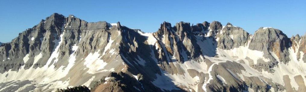
Summit view from Mount Belford.
Eventually the route eases as you near the summit. Continue to follow the trail to a point where it flattens out near the top. The final few hundred yards are over 14,000 feet and are fairly level hiking.

Summit if Belford, with Mount Oxford in the background.
The route is 8 miles round trip and is considered Class 2 hiking with low exposure. Total vertical gain is 4,500 feet. From Belford’s summit you can see Missouri Mountain to the south and Mount Oxford to the east. Oxford can be reached via a connecting ridge from Belford, but this will add another three miles and 1,000 feet of vert to your day.
Want to read the original trip report? Check out this link.
Bob Doucette

Sounds amazing
It was. And it was my first 14er.
Fair play
Beautiful picture!