Wildfires this summer are stretching government resources to their limits. (Uriah Walker/U.S. Army photo)
Nobody loves a good camp fire more than me. I can stare into the flames and enjoy that mellow nighttime vibe for hours.
But if I’m camping anywhere west of the High Plains, I’m not making one. And neither should anyone else this summer.
As of this writing, there are scores of large, active fires burning in the United States, and all but a few are in western states. Arizona has closed four national forests to visitors as massive wildfires there spread. Large fires are popping up in Colorado, Utah, New Mexico, California, Oregon, Washington, Wyoming and Montana, as well as in British Columbia. And given the lousy snowpack much of the West received this winter and spring, there’s a good chance fire conditions are going to worsen.
The western drought is so severe that lake levels at massive reservoirs such as Lake Mead are near record lows. That’s a sign that this drought isn’t just one season in the making. It’s been an ongoing trauma to ecosystems in much of the western half of the continent.
Topping it off is the widespread tree die-off from bark beetle infestations. The mountain pine beetle has killed about 100,000 square miles of forest in the North American west over the past 20 years, leaving behind huge swaths of dead trees from New Mexico to British Columbia – ready fuel to turn the smallest fire into an inferno.
I could go into the whole fire etiquette thing – keep the fire in a fire ring, make sure it’s out and cold before leaving it, etc. – but we’re past that now. Any open fire sheds embers and sparks, and as we’ve seen, it doesn’t take much heat to get a fire going. Carelessness with camp fires often leads to disaster, but given the conditions right now, even if you do everything right, you could still set off a wildfire.
Some would argue that natural events, such as lightning, are a bigger cause of wildfires than people, but this is a myth. In the U.S., almost 85 percent of all wildland fires are caused by humans.
These wildfires can – and do – cause real harm to people. Property damage from wildfires runs into the billions of dollars, and as we saw with the 2018 Paradise fire in California, the effects turned deadly. Eighty-five people were killed in that fast-moving, fast growing fire that razed a town.
A calming camp fire is a time-honored tradition, and we all like cooking over a fire. But you can use a camp stove to cook, and find other ways to make that camp experience more relaxing. This summer, we need to do our part and not light those fires.
There are some states where if you don’t find a way to get outside and step on a trail, you’re doing yourself a disservice.
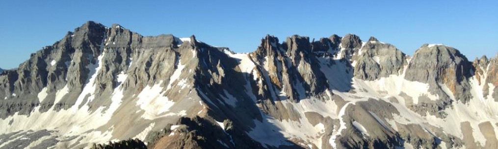
Washington is one of those states. Three mountain ranges cross the state from north to south: The Olympics, the Cascades, and to the east, the Selkirk Range.
The Selkirks won’t garner the love that the Olympics or the Cascades get, but if you’re in Spokane or the Idaho towns to the east, there’s plenty to do and see.
One of the simple pleasures for the outdoorist is a long mountain hike. And just east of Spokane Valley, you have one in Mica Peak.
The mountain is easy to distinguish: There’s a white, globe-like structure perched at its summit, like some giant golf ball awaiting God’s tee time (in reality, it’s an FAA radar station).
My hiking buddy on this one, Doug, lives in Spokane Valley and he sees the mountain every time he walks out his front door. He’s been eyeballing this ever since moving here with his family about a year ago. I needed a good training hike, so up we went.
There are a lot of trails on this mountain, and the paths themselves are a mix of jeep roads, singletrack and, close to the top, a wide gravel road. There are a lot of side trails, too, so it’s a good idea to study a map before you go. Otherwise, it’s easy to get off course (we did that a few times and turned an 11-mile out-and-back summit hike into some just over 13 miles. Oops.).
The basic route we followed was looking for markers that pointed toward “Moonshine.”
That path has you choose between what look like a fork in the road (really, two jeep trails) early on. The more established one to the left is the way to go. The route will mostly stay on a path like this following the ridgeline for a few miles. Some might balk at the idea of hiking on a jeep trail, but the scenery is just as good from it as it would be any singletrack. Sweeping overlooks into the valley to the west as well as nearby wooded ridges abound as you ascend, though we had a hard time seeing many of them because of the weather: Clouds, light rain and even some fog obscured most of the views on the way up, though there is an appeal to the look of a misty forest, where stands of trees disappear into the gloom of the fog. A whole different feel for sure.
Not far from the top, the route changes its spots: Double-track jeep trails give way to an abrupt right turn up a steep singletrack path that ascends sharply for about a quarter mile. Most of the route to this point is a gentle but steady incline, but now at about 5,000 feet, you give your legs and lungs more of a test. Once we topped out there, we were greeted by two things: a sweeping view of the valley below, and that gravel road I mentioned that continued up. The slope eased some here, and before we knew it, the FAA’s giant golf ball appeared through the mists. We’d topped out.
As I said before, the weather gave us light rain and drizzle most of the day. But by the time we were at the summit (and lunch!) it was 38 degrees and snowing. Yup, late May in the mountains – even mountains that don’t quite reach a mile above sea level – can bring snow. It was a tasty but chilly lunch, and we didn’t waste too much time getting a move-on.
On the way down, the clouds lifted a little, and we were treated to better views. There was plenty of evidence of wildlife (Spokane County maintains much of the mountain for recreation and as a nature preserve), be it droppings from deer or, we suspected, large predators. One paw print looked like it very well could have been from a decent sized cat. Mountain lions, black bear, moose, elk, deer and more call these woods home.
In the middle of all this was conversation. You know you’ve found a good hiking buddy when you don’t run out of words (though I’ll admit to clamming up on higher altitude peaks). Discussions included cars, family, sports, jobs and more. It definitely makes those miles tick by faster.
By the time we got back to the trailhead, the sun was poking through the clouds, which were busy trying to clear out. Mica Peak’s summit was still hidden in clouds, but somewhere up there was that giant golf ball in the sky, something Doug will be able to show his kids and say, “I’ve been up there.”
About the route: If you do it right (and not get off track like we did), the round-trip hike is about 11 miles with somewhere near 2,500 feet of vertical gain. All Class 1 hiking, with a short stretch of steeper Class 2 close to the top just before you reach the gravel road. The true summit is a fenced-off FAA site that does not have public access.
Artwork on display near the OSU-Tulsa campus, situated in the heart of the Greenwood District – home to what was once called “Black Wall Street” before the 1921 Tulsa Race Massacre.
NOTE: The following is an adaptation from the book“Outsider: Tales from the road, the trail and the run.” It has been updated to reflect the name change of the events of May 31-June 1, 1921, in the Black Wall Street area of Tulsa, as well as that of the district north of downtown.
***
There are some things I’ve learned while on the run. Sometimes I’ll take a route by the baseball stadium. It’s a fairly new ballpark for Tulsa’s Double-A baseball team, and it’s a nice one at that. You can actually get good beer there (not just the swill most ballparks serve), and they shoot off fireworks at the end of Friday and Saturday night home games. Any seat in the house is good, with picturesque views of the downtown skyline clearly visible over the outfield wall.
The ballpark sits at the corner of Greenwood Avenue and Archer Street, once the nexus of what used to be called America’s “Black Wall Street.” Back before 1921, Tulsa’s Black community had built up some thriving enterprises just north of downtown. But an accusation was made – a black man assaulting a white woman, something that was never proven – and that set off an armed confrontation between white residents of the city and folks who lived in Tulsa’s primarily black north side.
This mural, painted on a wall of an elevated portion of Interstate 244 in Tulsa, depicts the heights of Black Wall Street and also the violence that befell it. Starting on May 31, 1921, white mobs went on a rampage of murder and arson that leveled what was, at that time, one of the most prosperous Black communities in the United States.
It was a bloodbath. The Tulsa Race Massacre of 1921 left Black Wall Street a charred, broken ruin. An untold number of black-owned business and homes were burned, and while official figures on the number of dead are in the dozens, most historians put the body count in the hundreds. Black Wall Street was dead, and it died violently.
Northside residents rebuilt after the attack, trying to recapture the glory that the neighborhood once held. To an extent, they succeeded, but urban renewal projects, including a highway loop around downtown, razed many buildings and cut through the heart of the area. As the years passed by it degraded into a warehouse district with few tenants and high crime. In recent years it’s been revived as an arts district, with lots of cool galleries, music venues, clubs, restaurants and bars. There’s a hotel in there, too, and a great little park that’s home to concerts, a farmer’s market and people just hanging out or grabbing some grub from food trucks.
The corner of Archer and Greenwood, the heart of what became Black Wall Street in north Tulsa.
There’s also that baseball stadium, and across the street from it, a smaller, less conspicuous park that was built to commemorate the losses of the race massacre. It’s called Reconciliation Park, and it’s an incredible little green space. People who visit and take time to read the placards installed at various stations will get a chance to learn a few things about what were undoubtedly Tulsa’s darkest days. It’s great that we have this park; I wish it was bigger, maybe more dramatic, something befitting of all that was lost in 1921. I realize that doing so might have inconvenienced those who built the ballpark, the television station not far away, and all the trendy businesses nearby. I just hope everyone involved in the establishment of these places understands their prosperity is built on the ashes of someone else’s long-ago broken dreams. The Tulsa Arts District is a jewel for my city, alive with people and commerce. But that was also true of Black Wall Street in 1921. It just so happened that back then the people who flocked here were of a different hue than the rest of the city, a fact leaving them relatively powerless to stop the nightmare that burned the heart of their community to the ground.
I usually run through that park at least a few times a week. I make a point of it.
A view of downtown Tulsa from the top of Standpipe Hill in the Greenwood District of north Tulsa. Greenwood was once home to a prosperous business and residential area of primary Black residents, but was burned to the ground in the 1921 Tulsa Race Massacre 100 years ago. Residents would rebuild, but urban renewal – including the construction of an interstate highway pictured here that ran through the heart of Greenwood – prevented the area from regaining its former glory.
Mount St. Helens as seen in the summer. Bummer that I wasn’t afforded this view. More on that later.
In the days following the May 18, 1980, eruption of Mount St. Helens, I learned that ash from the volcano would eventually circle the globe. As a grade school kid living in the shadow of a bunch of other high mountains, the saga that unfolded in the Pacific Northwest fascinated me.
Years later, it still does. Maybe more than any single location in that part of the country, a visit to this scene of volcanic violence has been on my mind for some time.
I got a chance to head that direction last week, but with just two days to explore the area, this leg of the trip turned out to be a barnstorming tour, hitting the highlights of one locale briefly before moving on to the next.
It wasn’t enough, but at the same time, was plenty good. The drive west from Spokane to the Cascades stoked my appetite to see more.
Spokane reminds me a lot of Denver. It’s relatively dry, but gets enough snow and rain to support large stands of pine and spruce forests, which grow thicker as you move east. But 20 minutes west of the city, Washington state flattens and dries out, leaving a rolling landscape that supports mostly scrub brush, irrigated farms and sporadic vineyards.
But I noticed something else. Rocky outcrops occasionally jutted out the hillsides, revealing blackened stone. In the fields, rocks of similar composition littered open rangeland. It reminded me of the vast grazing lands of northeastern New Mexico, territory no good for farming because underneath thin topsoil were the hardened remains of ancient lava flows.
Washington, like the rest of the West Coast, is known for its seismic activity. The great Cascade peaks are all volcanoes, powered by an offshore subduction zone where one tectonic plate reluctantly slides under another. Once these fault lines slip, massive earthquakes and tsunamis can result. Pressure deep underground also pushes magma to the surface, which in turn erupts to form the enormous piles of ash and rock that, on most days, look like grand mountain scenes.
But here I was, hundreds of miles from that fault line, and evidence of volcanic activity was all around.
The mighty Columbia River, seen from an overlook east of Yakima, Wash.
It became more stark once Interstate 90 crossed the Columbia River. A deep gorge has been carved into the landscape, with layers of volcanic rock exposed by the gash in the earth carved by the river. It’s worth a stop to take it in.
Across the bridge, the landscape begins to change. The gentle hills of the middle of the state give way to bigger, steeper slopes. In the distance, barren mountains appear. And beyond them, you can see the snowy peaks of the Cascades.
I knew that once we entered the range, it would become much greener. But out here, the rain shadow of the Cascades leaves behind a desert that extends south into Oregon. Most great mountain ranges do this: On one side of the range, atmospheric moisture is hemmed in, dropping rain and snow in abundance, creating lush forests and grasslands. The other side is left with thirsty scrublands and deserts.
West of Yakima, there are a number of roads that lead to Mount Rainier National Park, the first stop on this jaunt. Mount Rainier is a bucket list climb for me, so seeing it was high on my list. As it turns out, even in mid-May a number of passes and roads leading to the park are closed, still buried under snow. But we got there, only to be greeted by thick clouds and occasional rain.
Mount Rainier, with its upper reaches obscured by clouds. This would be a theme.
I knew the mountain was huge – much bigger in mass than anything in the Rockies, and at 14,410 feet above sea level, one of the highest peaks in the contiguous United States. We got to see the peak up to about 10,000 feet, and it is indeed enormous. This much I would tell, even with the top 4,000 feet or so socked in by clouds. Funny thing about the Cascades – they don’t always avail themselves to the views craved by tourists. We saw what we could see, then beat a path toward Mount St. Helens.
The hope was that the weather that cloaked Rainier would clear out by the time we got to Mount St. Helens. But all the way up the road leading to the Johnston Ridge Observatory, it was clouds, rain and fog. There was a good chance there’s be nothing to see at all.
Once we got there, we got what I’d call “a true mountain experience.” Winds were hitting us at 20-30 mph, laden with rain and sleet. Once at the observatory, most of the mountain was shrouded in swirling gray mists.
Oy. What to do. I could see right up to the bottom of the crater, but no further. Socked in again. But with the winds blowing hard, I thought there might be a chance it would blow enough of the cloud cover away to reveal more of the mountain.
Mount St. Helens, mostly hidden by clouds and fog. Still pretty impressive.
So I hiked out on the ridge, my attempt to wait it out. Clouds whipped by, and high whistling sounds whipped through the tree limbs of the few evergreens that were growing out here. Once lush with old growth forest, Mount St. Helens erupted with such violence that it wiped out thousands of acres of woodland, buried Spirit Lake, and caused a collapse of the mountain that caused its summit elevation to drop by more than 1,300 feet. Pre-eruption, its near-perfect conical form earned it the nickname “America’s Mount Fuji,” but now it’s shaped like an amphitheater, with a small but growing lava dome at the bottom of the bowl of the now hollowed-out mountain.
Even with so much hidden from view, seeing the landscape around the mountain was fascinating. Grasses and willows now carpeted the scarred land, the area a mix of browns and light greens surrounded by forest covered ridges. I imagine from the air, it looks like a giant scar (which it is), with Mount St. Helens at the epicenter.
Hiking out on the ridge, I fought the winds, the cold and the rain. One day I’d like to hike the munros of Scotland, and I imagined the weather was a lot like this. I confess to having the wrong clothes to be out there in those conditions, so it didn’t take long to get a bit soaked. Hiking back to the car, I gave up waiting out the mountain, snapped the best pics I could and called it a win. It’s a marvelous place, and I hope to come back on a day when the weather is more forgiving.
Multnomah Falls, Ore. Highly recommend this accessible stop along the Columbia River Gorge.
A night’s sleep means turning back east, but not before making one last stop, this one requiring far less effort. On the Oregon side of the Columbia River, east of Portland, tall waterfalls drop from steep cliffs. Of these, Multnomah Falls is the most dramatic. A thin, silvery band of water drops 611 feet from the cliffs above, falling into thickly wooded, moss-covered basins below. The drive to the falls is pretty, and you can pull over to see other handsome waterfalls as well. But Multnomah is the monarch of the Columbia River Gorge falls, made more majestic by a bridge centered about a third of the way up that makes for an excellent viewing deck. Scores of camera-laden tourists happily made their way up to the falls, looking for that perfect pic. Honestly, you’d have to have terrible photo skills to not get something gorgeous.
Driving back east toward Spokane became a review of what was seen on the way out west. It’s easy to looks at landscapes and see “mountains,” “deserts,” “hills,” “rivers” and whatnot. But what struck me is that all these landscapes were related, made the way they are because huge pieces of the earth are in a slow-motion collision eons in the making. Everything is connected here, born from the same ongoing geologic trauma. Sometimes that brings on cataclysmic eruptions or earthquakes. But on nearly every other day, we’re given natural spectacles that stick in our memories for years to come.
Pastoral scene, with Mount Hood in the background.
The bright green of new, spring foliage has been intensely beautiful.
I’ve fallen into a pattern over the past several years where hiking fell into two categories: a short, leisurely stroll in the woods or all-out summit hikes high in the mountains. Missing in that group is what I’d call the really important middle: training hikes.
I’d long chosen to use a bunch of other forms of fitness to get me ready for the mountains — running, cycling, team sports, weight lifting, etc. But hiking? Curiously missing. The truth is, I became so invested in that weekend long run or Saturday powerlifting session that I couldn’t make room for something so basic as a healthy, hard-working training hike.
Frankly, this left me unprepared. Even when I was lifting hard or in marathon shape, difficult hikes were almost prohibitively hard. In same cases, a lack of “hiking” shape cost me a summit.
And it’s not like I didn’t see it coming. Any serious backpacker or mountaineer would tell you so. And a few years back, I went to a seminar by RMI where I asked their climbing guides what they did to get in Rainier shape. The answer: Hike a lot, with a load on your back, and make sure there’s plenty of uphill involved.
So this spring I’m making a point to do those “middle ground” hikes with some weight on my back on the weekends. No long runs, no barbell sessions. Just me, a loaded backpack, and some wooded, hilly trails.
I’ve discovered some thing that are really no-brainers, but were educational nonetheless.
First, even hikes between 4 and 6 miles are making me sore. That’s pretty telling.
Second, Getting these regular hikes in has me moving more fluidly and pain-free than I’ve been in many years. And the carryover into running and lifting has been positive.
And lastly, it’s helped me re-embrace the outdoors in a more thorough way. Yes, I’ve been able to enjoy my outside time running and cycling, but it’s different on a hike. The more deliberate pace (even when working hard) has allowed me to really soak it in.
Some images from my most recent hikes include some really spectacular spring scenery.
Wildflowers in a meadow at Turkey Mountain.Singletrack through the green tunnel.More wonderful singletrack with a healthy forest canopy overhead.
Unusual trees, scenic overlooks and more have also been a part of the journey.
An overlook with a view of the Arkansas River, which has been pretty fully this spring.This large tree has sort of a broken arch feel to it. Anyway, it sticks out.There are several ponds at Turkey Mountain, including this one dubbed Pepsi Lake. Many have fish, and at least one pond is home to a beaver, complete with a den.I call this part of the trail the Cleft in the Rock. It’s a midpoint on a trail called Ho Chi, which has some pretty tough spots for runners.
It’s also important to remember that this place is wild, and as such, is home to wildlife. In my years of running and hiking Turkey Mountain, I’ve seen deer, owls, lizards, snakes, rabbits, armadillos and any number of other creatures. It’s our park, but we’re visitors. It’s their home.
An adult copperhead I saw hiking last weekend. Copperheads are venomous, so it’s a good idea to give them some room. But also, here’s a good reminder: When you see a snake of any kind, leave it be. Don’t kill it, poke it, move it, pick it up or throw things at it. Just give it room and leave it alone. They’re an essential part of the ecosystem, so it’s good to respect that.
It’s silly to me that I haven’t been more consistently hiking, seeing that it’s played such a big part of my life. But you know how it goes: Training for a race takes over, or some other goal crops up. Work or family obligations arise. Something’s gotta go, and too often for me that’s been a healthy hike. But as summer nears and the mountains call, I know I need to do more to be ready. And what’s more, I don’t need to rob myself of the benefits that a walk in the woods provides.
Some of the more than two-dozen volunteers who showed up to cut and build a new trail at Turkey Mountain.
We hinted about this during the winter, but last weekend it finally came to pass: The first project to close a bad trail and replace it with a good one at Turkey Mountain.
A crew of more than two dozen volunteers with the Tulsa Urban Wilderness Coalition grabbed tools and marched a mile or so into the woods to carve a new path that the River Parks Authority (the land manager for Turkey Mountain) hopes will be an enjoyable – and sustainable – trail.
At the same time, the trail it replaces – one that goes straight down the slope of the ridge and has been prone to severe erosion – is being closed off so it can grow over and heal.
This is the first of what could be a number of trail reroutes at Turkey Mountain. The park is criss-crossed with trails that were created by mountain bikers and hikers decades ago. Some of these trails are great. But others were made more for the aesthetics of the moment, only to fall into irreparable disrepair. Volunteers have spent the previous several months identifying “rogue” trails while other established routes are being evaluated to see if they can be managed and salvaged, of if they’ll need to be closed off and rerouted.
The finished result of a new section of trail on Turkey Mountain.
The final product of last weekend’s work is solid. It lengthens the route and provides some switchbacks to ease the climbs while also making the trail surface more durable. It links a popular spot we call “Rock City” to the Westside YMCA camp on the western edge of the park.
Many hands made for light work, and within a little more than three hours, hikers, cyclists and runners were already using it.
I know that some people might not like seeing some of their old favorites go away, but this has to happen if we want to keep the trail system and the forest around it healthy. In the long run, the experience will be improved for Turkey Mountain’s users.
Proof that I wasn’t just leaning on a shovel while others did the real work. 😉 (Laurie Biby photo)
Another plus: These volunteer days are bringing together a wide spectrum of Turkey Mountain’s users. Volunteers from the group represented pretty much everyone who treads these paths, and everyone involved is not only able to put in some sweat equity, but learn the thinking behind trail building, not to mention the skills that work involves.
More work like this will be done, along with maintenance on existing trails (plenty of trouble spots have been identified) and trash cleanup. Looking toward the long term, work at Turkey Mountain will hopefully get us closer to realizing the ideas behind Turkey Mountain’s master plan.
After a good number of hours at work, a bunch of us did what all good trail hounds do: We hung out in the parking lot, enjoyed a few refreshments, and had a can crushing contest. I did not win.
There is something special about being involved in creating something new, and I imagine more opportunities for that are on the way. Stay tuned.
I’m just saying, maybe we should ask different questions about our fitness during the pandemic.
There are two competing messages in regards to what has happened to people’s fitness during the pandemic.
The first goes something like, “Here’s how to lose all those pandemic pounds!” Or something like that.
The second is a stiff counter narrative, admonishing people to give themselves grace if they’ve added a few, and scolding those who, in their minds, are guilt-tripping people over their inability to uphold a body image ideal during a stressful time.
In both cases, the focus is more or less on appearance. What I’m going to suggest is scrapping both narratives for something more useful.
But first, let me tell you a personal story. It goes like this:
When the pandemic hit the U.S. in earnest about a year ago, my gym shut down. I did workouts from home for a couple of months until it reopened. I waited to see how serious the gym’s management would take COVID-19 safety protocols, was satisfied with their work and started up again. So I began lifting hard, eating to gain some muscle, and running less. Seeing that in-person races weren’t on the horizon, I figured I’d go all-in on the lifting and run just enough to keep up a measure of cardiovascular fitness.
The good news is that I got a lot stronger. I gained some muscle mass. And I was “fit” enough to do some of the more taxing things I love.
The bad news is that without the normal fall race season, I didn’t have that one piece of my training that kept my weight in check: long runs, speed work, and plenty of mileage. Once summer ended, I didn’t switch to race training. I just kept doing the same thing I’d been doing since May.
As my strength gains peaked in February, my body did what everyone’s will do: Plateau. It’s inevitable that any strength program has a shelf life, and the fact that I was able to use mine for nine months and see gains throughout that time is astonishing. But even then, a ceiling was reached.
I got stronger during the pandemic. But I let some things slide that are biting me in the butt right now.
And by consistently eating more than normal (sometimes by design, and sometimes because work-from-home = easy access to the fridge), my body did what a lot of people’s bodies will do: It stopped using those extra calories for muscle-building and started storing them as body fat. There’s a term for it: insulin resistance. And it’s a bad thing. So while I picked up a good amount of strength, I also gained a bunch of extra weight in all the wrong places: in my belly, around my waist, and very likely around my vital organs. Needless to say, that’s not healthy.
I found that as I got heavier, all the other things I liked doing – running, biking and hiking – all got harder, and not just in terms of being winded. My back, hips, knees, ankles and feet all let me know that carrying around a lot of extra weight was doing harm.
So I have a choice: live with my new pandemic pounds or get rid of them.
Going back to my original point about the two competing narratives: In both cases, the focus is on the wrong thing. On one side, you’ve got someone urging you to look your best, and on the other is one telling you to love your body as it is. On the surface, neither is necessarily wrong. But the question they pose is.
What should the focus be? Answer: How is my body performing?
How I see it, body “performance” is examined in two ways. I’m going to use really general terms to keep it easy. One way is “internal” and the other is “external.”
Internal includes things such as how well your cardiovascular system is oxygenating your body. Is your heart working harder than it should? How’s your blood pressure? Does your current physical condition compromise your immune system? Are the habits you picked up during the pandemic negatively affecting your metabolism? How well are you sleeping compared to pre-pandemic weight gain? Are your internal organs functioning properly? How does your blood work look? If the answers to these questions fall to the negative side, this isn’t a question of “body love.” This is a question of your short- and long-term health prospects.
External has to do with how your body moves. Are you more gassed from walking a flight of stairs? Are you finding that your back hurts more? How are your hips, knees and ankles feeling when you’re out for a longer walk? Or when you run? Or after a tennis match?
If you’re more athletically inclined, how are your times looking on your training runs? Or when you’re on the bike? Are you falling further behind your pre-pandemic athletic performance? If the answer is yes, then you’ve got work to do if you want to regain those abilities.
The fact is this: We beat ourselves up with false narratives on body image. BMI is a joke, but it’s still used. We look at “the ideal” and conclude we’re slacking if we don’t resemble fitness models or Instagram stars. All of that needs to go away if it’s undermining your mindset. I’ve seen plenty of people who don’t have the right “numbers,” whether it’s body composition, BMI, weight on the scale, and so on, but their bodies look just fine and they are physically capable of doing all the things they love (my fastest 5K time happened at a weight that was 15 pounds more than when I ran my second-fastest time). And often, they are internally very healthy people.
But if your body is not performing well – internally and externally – then now is not the time to hold back. If you can’t run or play a sport like you want to, or hike as far or as much as you used to, then the joy of those pursuits is stolen.
If I’m going to get back to this form, I’ve got some work to do. And body image has nothing to do with it.
More critically, if your body is not performing well internally, then you’re staring down a future filled with potentially expensive, painful and possibly debilitating health problems. Let that go on too long, and they can cascade. If your pandemic pounds aren’t hurting you and you’re fine with how you look, don’t let anyone guilt you into doing/feeling anything. But if those pandemic pounds are robbing you of your health, it’s time to act.
Seen on a recent trail cleanup day. Volunteers hauled out trash and did some pruning and basic trail maintenance at Turkey Mountain in Tulsa.
Interesting things are underway on my local trails. Turkey Mountain used to be a place that was occasionally used but often neglected. As it became a more popular place for people to go, we saw more intensive efforts to clean up trash and repair badly damaged sections of trail.
But lately, stewardship of Turkey Mountain has matured. All of the other activities are still happening, but there is an increasing emphasis on making this patch of woods and its trail system more sustainable.
Earlier this winter, a work day included some routine trash pickup and pruning to keep the trails clear. But we also spent some time on habitat restoration.
Part of the recent work at Turkey Mountain: Closing off rogue trails and marking them as ecological restoration areas. Public lands entities have used this practice for years in an effort to repair areas damaged by misuse.
What this entailed was closing off rogue trails that had been marked earlier in the year and installing signage to tell people to let that area be for a while, and let nature take its course in getting it back to a more natural – and sustainable – state.
The National Parks System and the National Forest System has used similar practices to promote healing/repair to sections of trails that had become too worn or were chronic erosion problems. It’s become standard practice, especially in environmentally sensitive areas, like alpine tundra. Damage in those ecosystems can take several years to become whole again.
Habitat restoration work in progress at Turkey Mountain in Tulsa.
At Turkey Mountain, the scars will heal much faster. Temperate woodlands are remarkably resilient. But heavy usage – by hikers, runners, cyclists and others – means a lot more wear and tear. And to be frank, many of these trails were not made with much attention given to the effects of erosion. That’s made several trails turn into ugly, rutted washouts, brown gashes exposing rocks and tree roots that promise to get worse. So I imagine we’re going to be doing restoration work on several areas for many years to come.
More recently, a group went out to scout out more areas where trail work can be done. There are big plans for Turkey Mountain, ideas that focus on making trails more durable while keeping the park as wild as it can be. Some trouble spots were identified, and in looking at these places I walked some paths I hadn’t seen before. There are ponds all over Turkey Mountain, but I didn’t know that one of them (one I hadn’t seen before) was a substantial beaver pond, complete with a lodge. It’s a good reminder that while the park is in the middle of a city, it’s still home to numerous species of wildlife. We enjoy recreating there, but for these creatures, Turkey Mountain is home. Food for thought not only as we work there, but also in terms of how we play there.
The River Parks Authority in Tulsa is working with volunteers and experts to identify future areas of trail work that need to be done at Turkey Mountain. On a broader scale. RPA is working toward implementing a master plan for Turkey Mountain aimed at balancing outdoor recreation needs and conservation for long-term sustainability.
More big news from Turkey Mountain is coming. The pandemic delayed or canned some plans, but with COVID-19 finally starting to loosen its grip, there’s a chance that a lot of the education programming, athletic events and other activities that were put on hold can resume.
It’s not lost on me that just a few years ago, the future of Turkey Mountain was in doubt. Single-year leases, a hodge-podge of privately owned parcels and a proposal to turn a chunk of it into an outlet mall made the park’s outlook unclear. It doesn’t seem that way now.
Volunteers scope out places for future trail work projects.
Summit dreams are powerful, and there’s nothing quite like the views. But being physically ready — or practiced — is key to being successful.
I could probably make a checklist of more than a dozen things to know before you tackle climbing a 14,000-foot peak. I wrote a series about it starting with this post. But the other day, I was thinking about how to boil down the issue into a couple of simple ideas before you get going.
More specifically, what can you do to get ready for the physical tasks of gaining a 14er summit?
On any of the 58 in Colorado, or the numerous 14ers in California, there are two things you’ll likely confront: Steep uphill hiking and “scrambling,” which is a fancy term for basic climbing.
Obviously, operating at high altitude is going to require a high level of cardiovascular fitness and stamina. How you get there – running, cycling, or some other form of exercise – is up to you. But in the midst of all that, there’s this:
You’re going to spend hours hiking uphill, and it is it’s own type of fitness. Solution: Find steeper uphill terrain and hike it. A lot.
You need to spend a good amount of time walking steep uphill inclines. Walking uphill sounds basic enough, but it is different than other forms of exercise, especially if the trail you’re hiking is steep. I heard a presentation from some professional mountain guides, and when asked if running or cycling would be sufficient, they said “no.” Instead, they advised loading up a backpack, finding local mountains or hills, and spending time hiking up those slopes. Don’t have hills? Find some staircases. Many gyms have stairmills, which will do in a pinch. Even if you’re hiking a mild route, expect to spend hours walking uphill in thin air, and possibly up steep grades. Work your way up to multi-hour hikes with increasing miles and plenty of vert. May as well get used to it now rather than gas out a mile into your ascent.
Not every mountain is something of which you can walk to the top. Some involve scrambles and climbs, and that’s a whole other physical skill set. If you feel comfortable climbing, more challenging mountain routes won’t seem as daunting.
If you’re going to tackle peaks with Class 3 or 4 routes, take up rock climbing. Routes are ranked 1-5, with Classes 1 and 2 still firmly in the realm of hiking. Once you hit Class 3 and higher, you’ll need to use your hands to help you ascend. On Class 4, the climbing becomes more challenging, the routes steeper and the moves more committing. Class 5 involves roped climbing, and there aren’t any standard routes on the Colorado 14ers that are Class 5 (though many alternative routes with this classification exist). Rock climbing, whether it’s in a gym or outside on natural crags, will get your mind and body used to the movement required and will help you become accustomed to heights. Both are hugely helpful when you’re on a mountain with big air around. Climbing with friends will add input and encouragement. When you get to the point of regularly completing 5.7-5.9 climbing routes, you’ll be ready to roll on just about any Class 3 or 4 route on a mountain.
In both cases, practice makes perfect. There are a ton of other considerations when climbing mountains, but these two are the foundation. You need to have your body and mind ready for the task, and the best way to do that is spend time doing the things you’ll be doing when you’re on the mountain.
I live at a latitude that is not conducive to much snow. It happens on occasion, rarely accumulates and sometimes doesn’t even stick. Winter in the Southern Plains is mostly a brown and grey affair.
Not that I mind these winter hues, but I grew up in snowier climates. So sometimes I miss the white stuff.
Last month, we got a solid dump. I’d hesitate to call it a blizzard, but a good, heavy dose of thick, wet snow dropped somewhere around 5-6 inches on my city. And as anyone will tell you, I like to hike on days like that.
Here are some pics that show one of my favorite hiking spots about a week before the storm…
Still some green in there.Bare trees and a bunch of rocks.Okie forest, stripped bare of their greenery.Low winter sun, lichens, shadows and stone.
There’s beauty just about anywhere at any time in the forest. But cover it in a bunch of snow? It’s like you’re in a whole other world.
The weight of the snow made this cool looking arch. Too bad I couldn’t claim first tracks. But I had it to myself for most of this hike.Remember this pic at the start? With stone and lichens? Here we go again, but with a blanket of snow on top.
I don’t have anything profound to say about these two hikes, other than the fact that winter, while sometimes dreary and dark, can be gorgeous and inviting. It was well worth the chill to see what the woods looked like with this frozen bounty.